
Maps and disposition of Mexican-era ranchos

"Diseño del Rancho de San Pablo" drawn in 1830 by James Alexander Forbes; also known as the "Forbes map."

1856 composite map of San Pablo Rancho by U.S. Surveyor Nicholas Gray

1856 composite map of San Pablo Rancho by U.S. Surveyor Nicholas Gray - northwest quadrant

1856 composite map of San Pablo Rancho by U.S. Surveyor Nicholas Gray - northeast quadrant

1856 composite map of San Pablo Rancho by U.S. Surveyor Nicholas Gray - southwest quadrant

1856 composite map of San Pablo Rancho by U.S. Surveyor Nicholas Gray - southeast quadrant

Rancho San Pablo map (western portion)

Rancho El Sobrante final partition map. Click here for the final partition report.

1909 County Recorder’s Map of Sunset View Cemetery

1894 map of Rancho San Pablo. Click here for PDF.
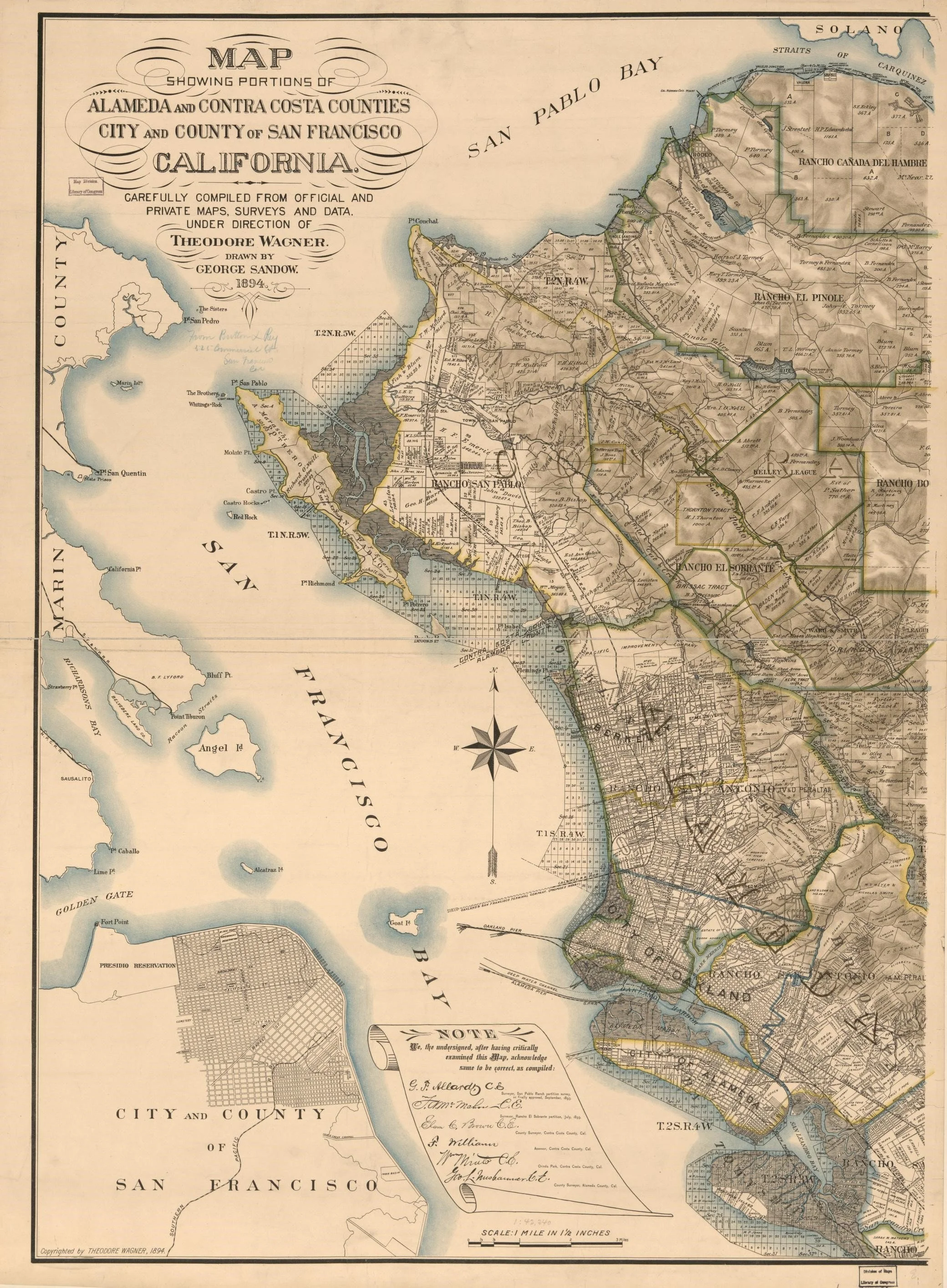
This map, which shows portions of Alameda and Contra Costa counties as well as San Francisco and Marin, was published in 1984, and created from carefully compiled official and private maps, surveys and data. The map shows how the Rancho San Pablo, stretching from the Alameda County line to Pinole Valley, was partitioned after years of legal wrangling over deeds and claims. Map is from the Library of Congress.

Adobe location (Sanborn, 1925) superimposed on map of El Cerrito Plaza (ca 2000).

1976 City of El Cerrito map showing possible location of Castro Adobe orchards, vineyard and family cemetery. Rectangles at right show commercial buildings at El Cerrito Plaza shopping center.