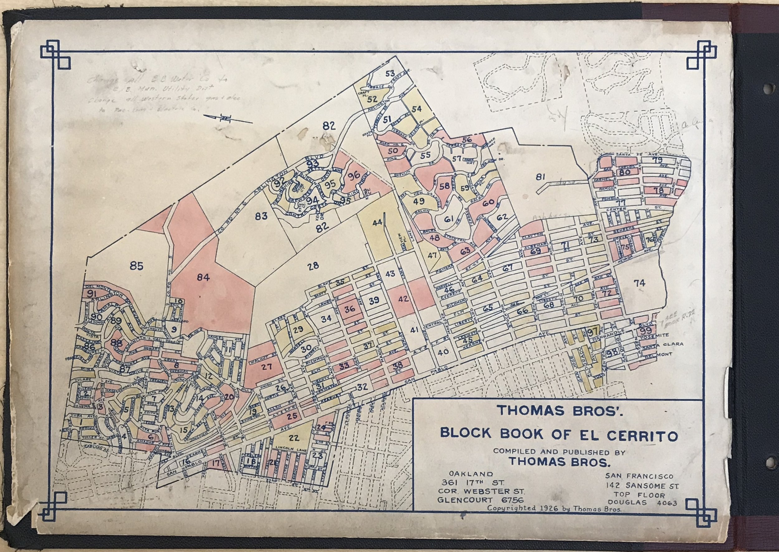
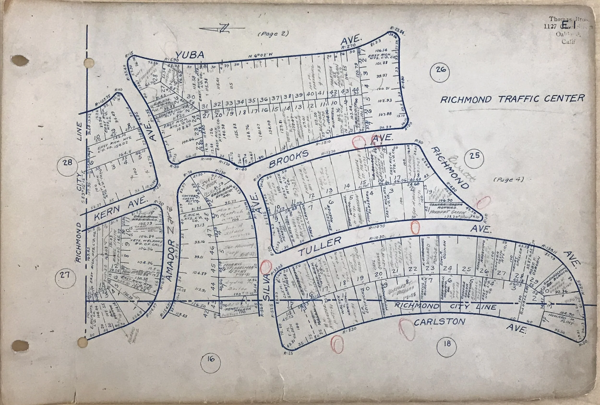
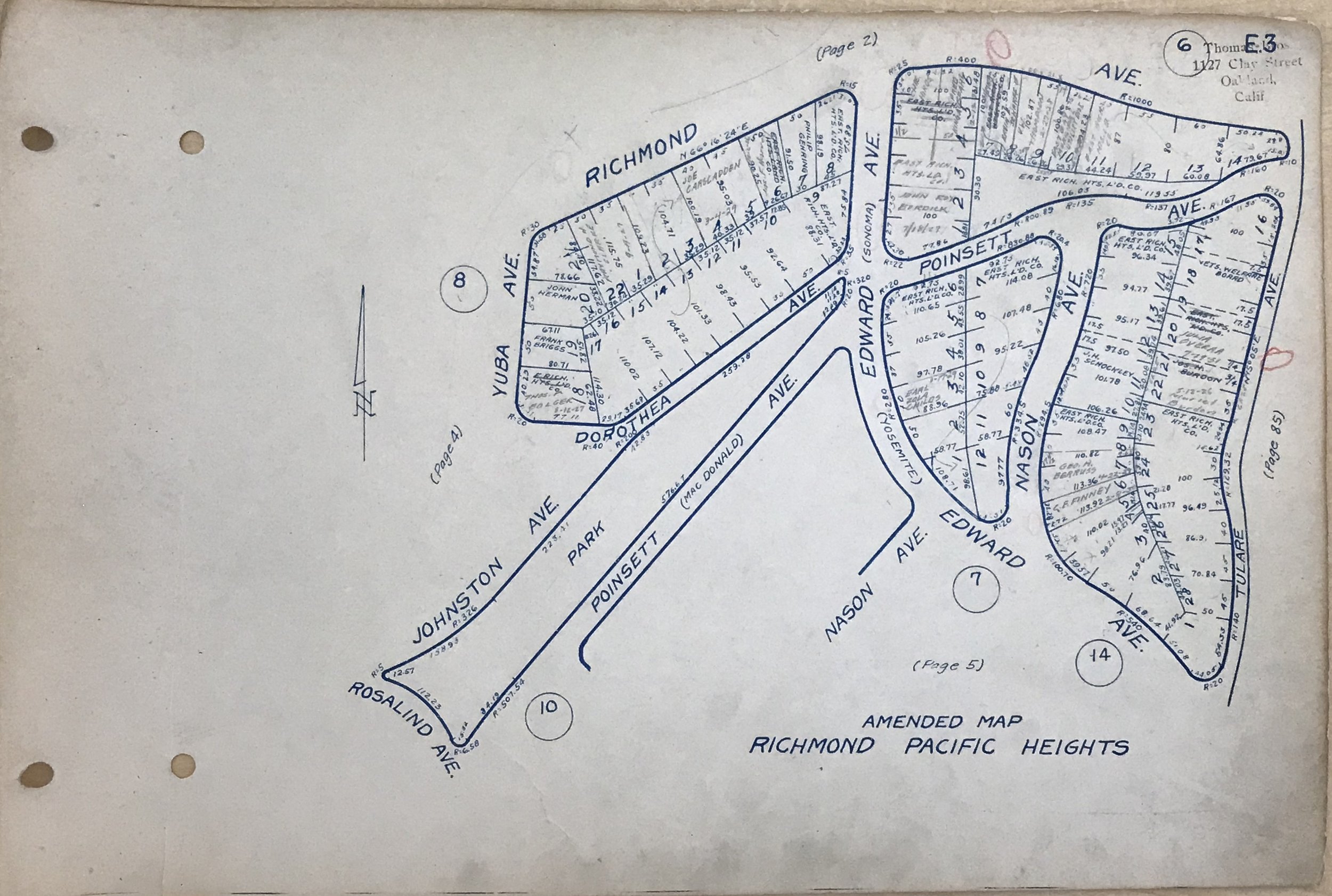
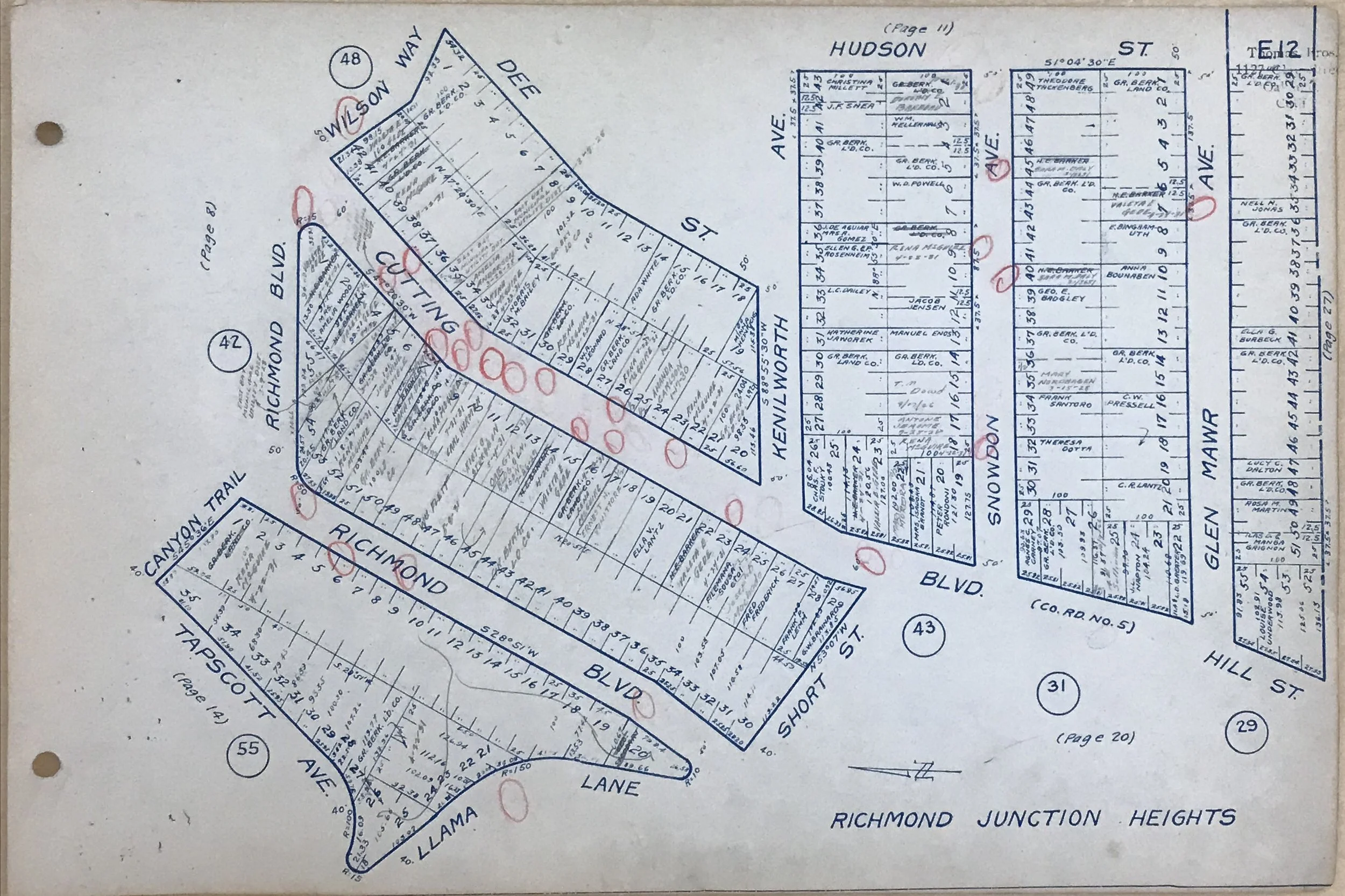
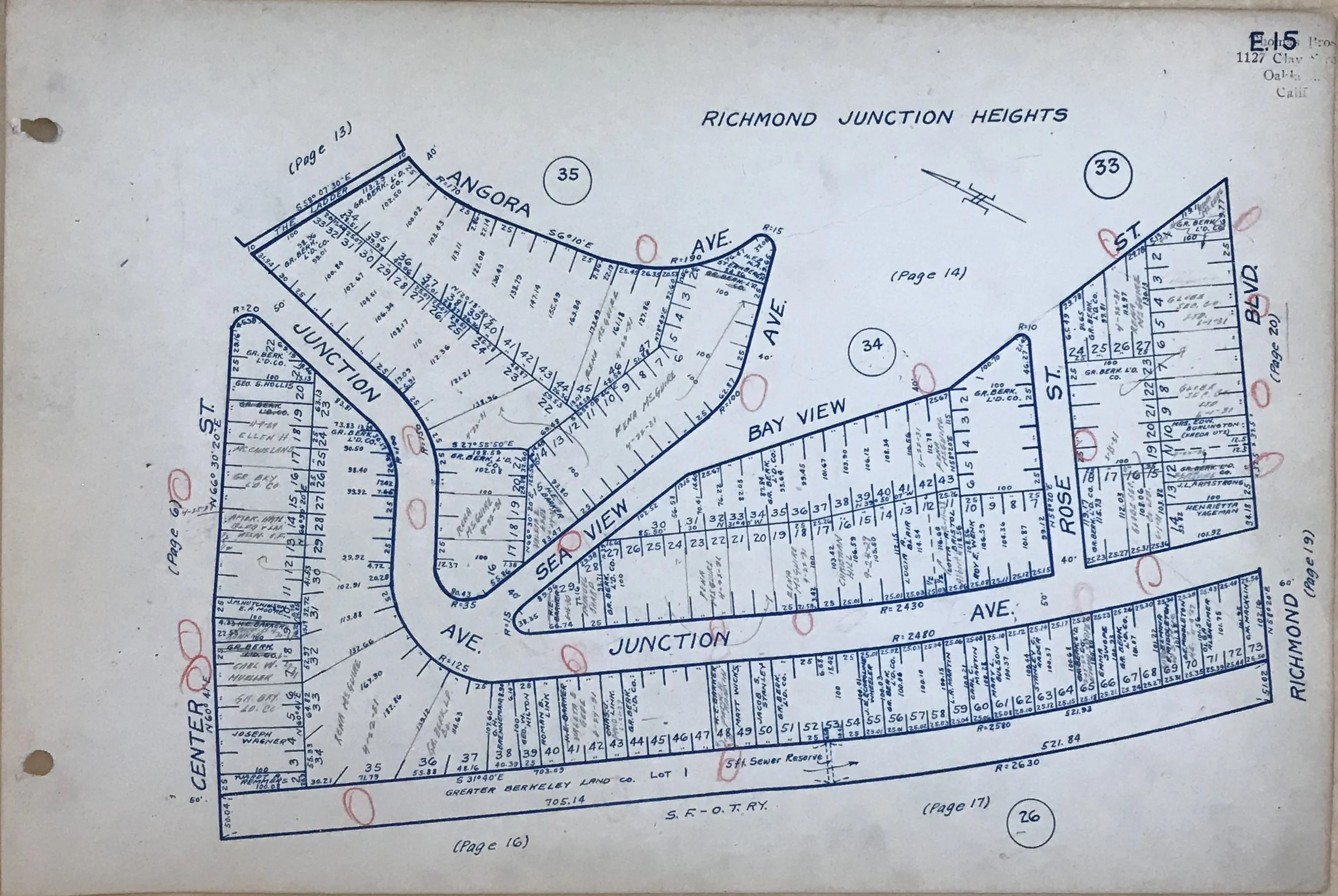
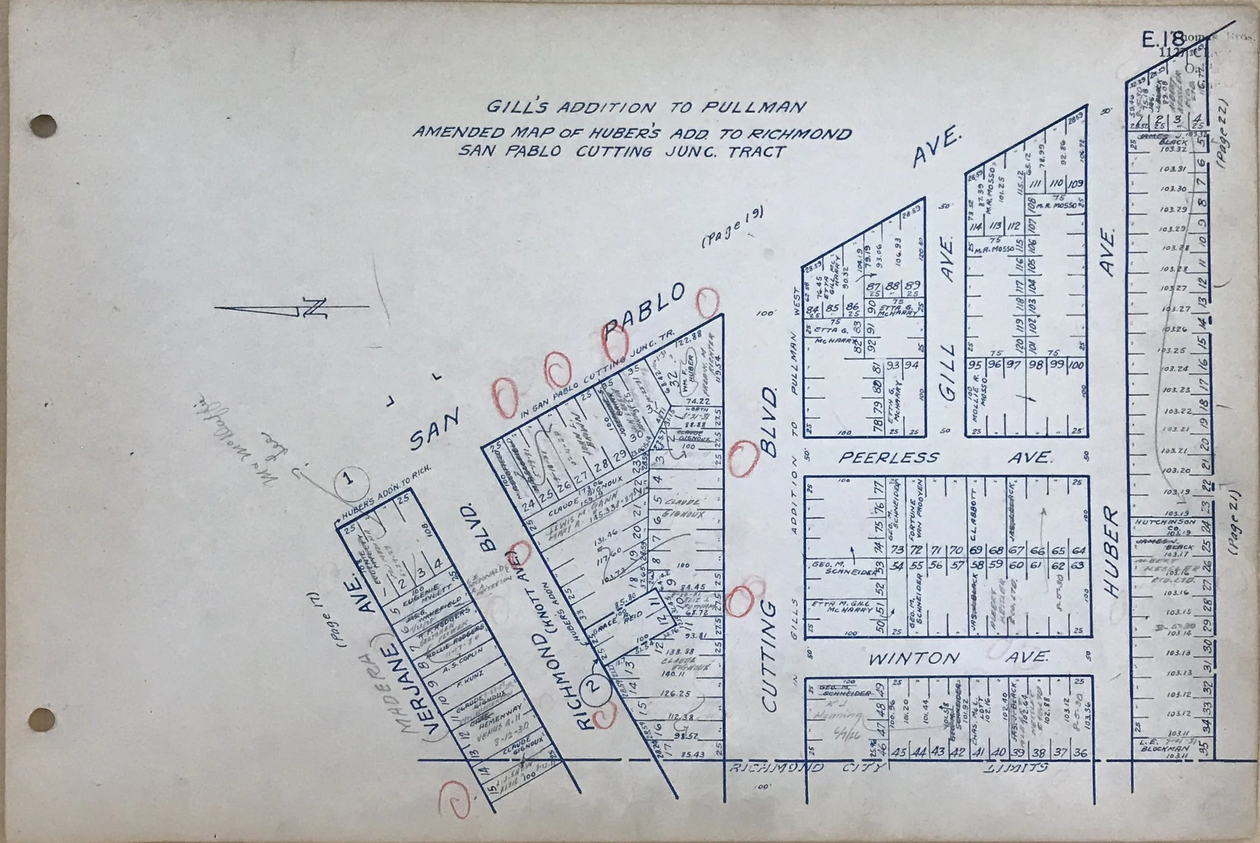
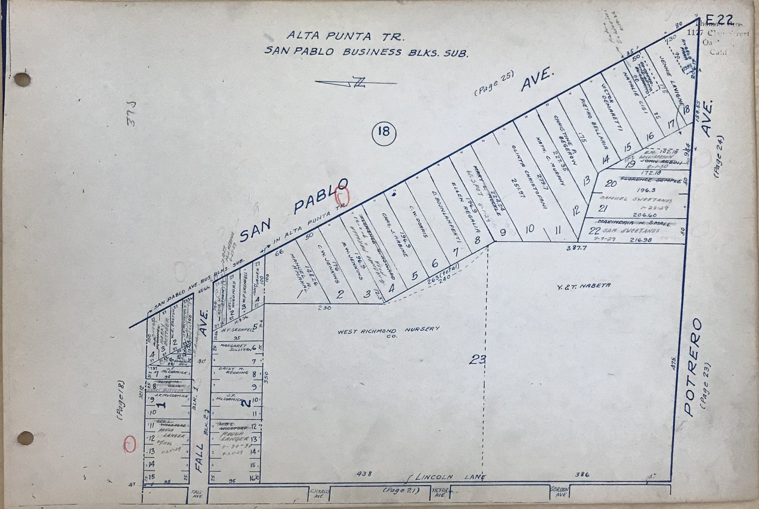
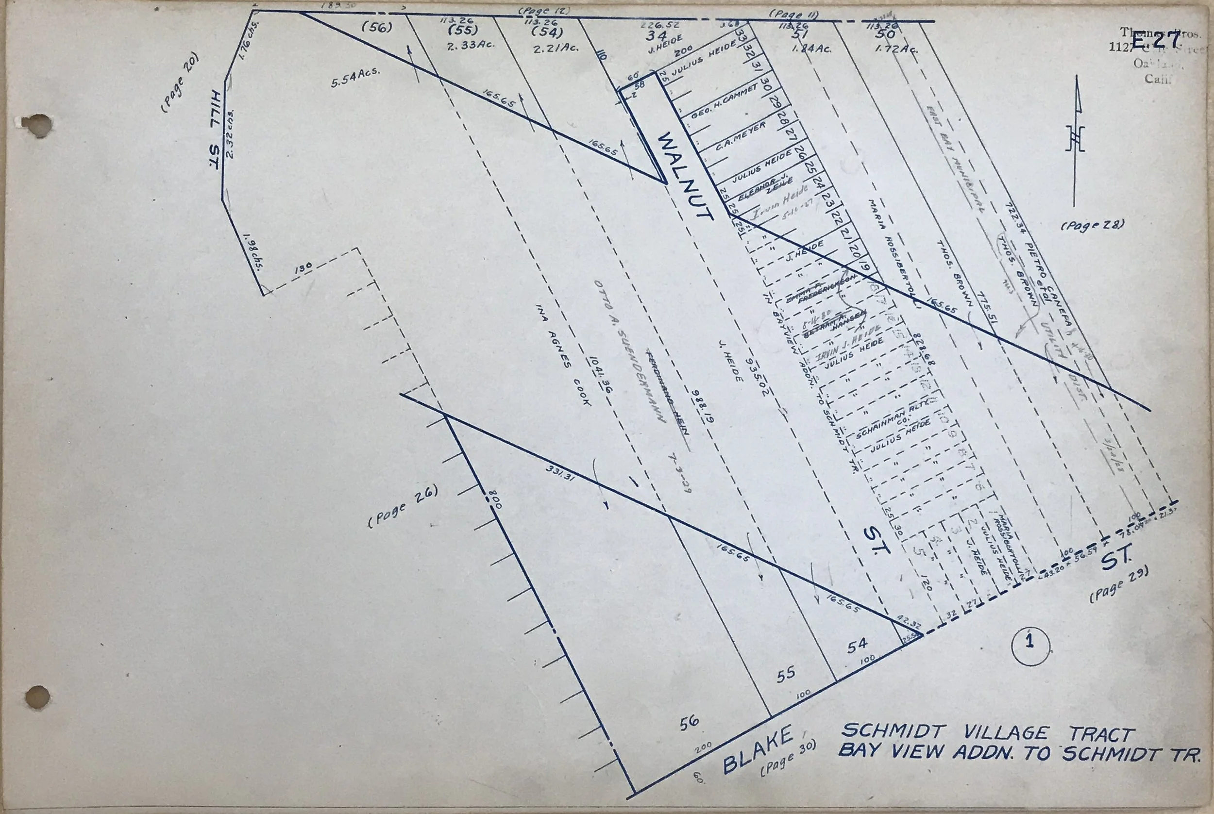
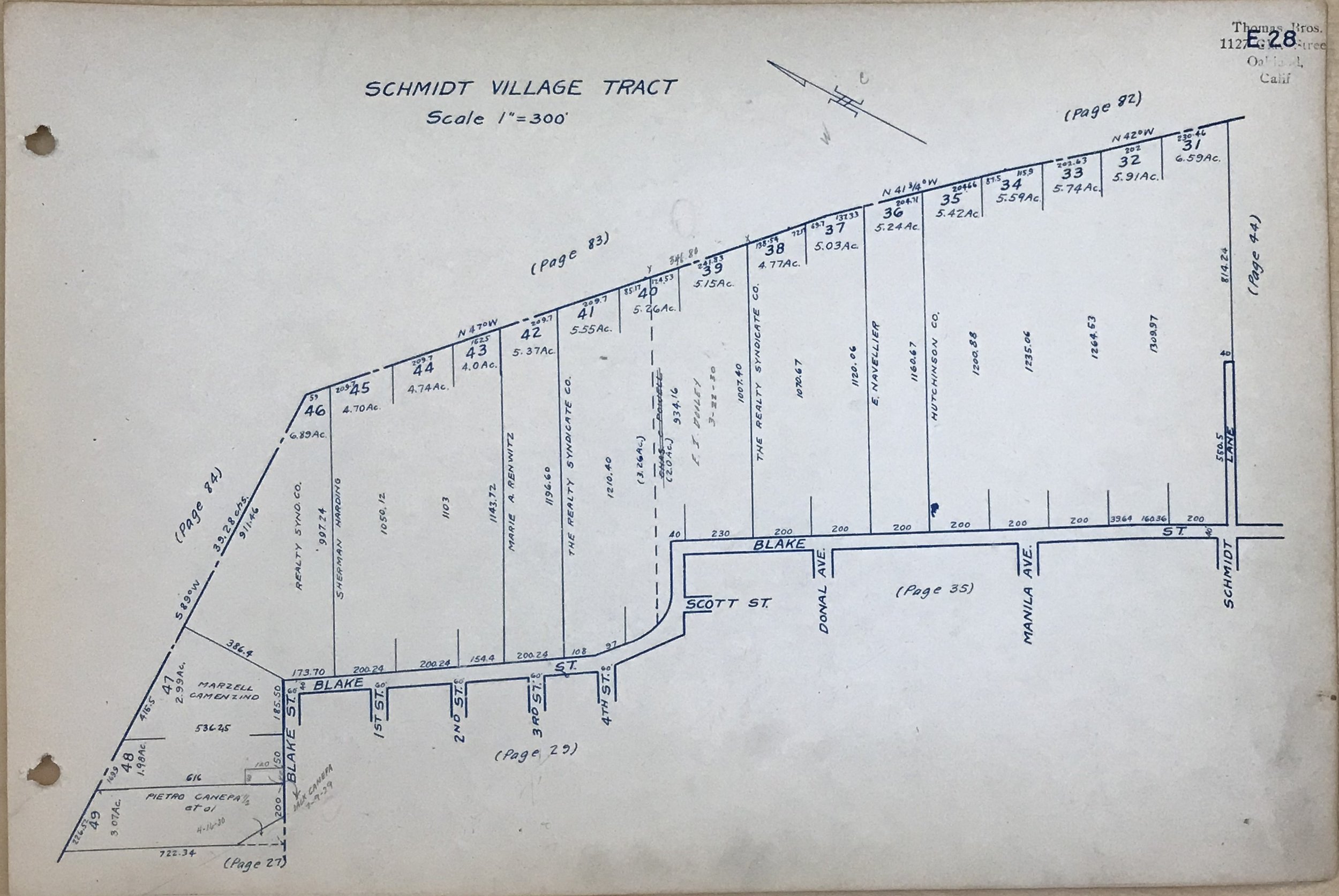
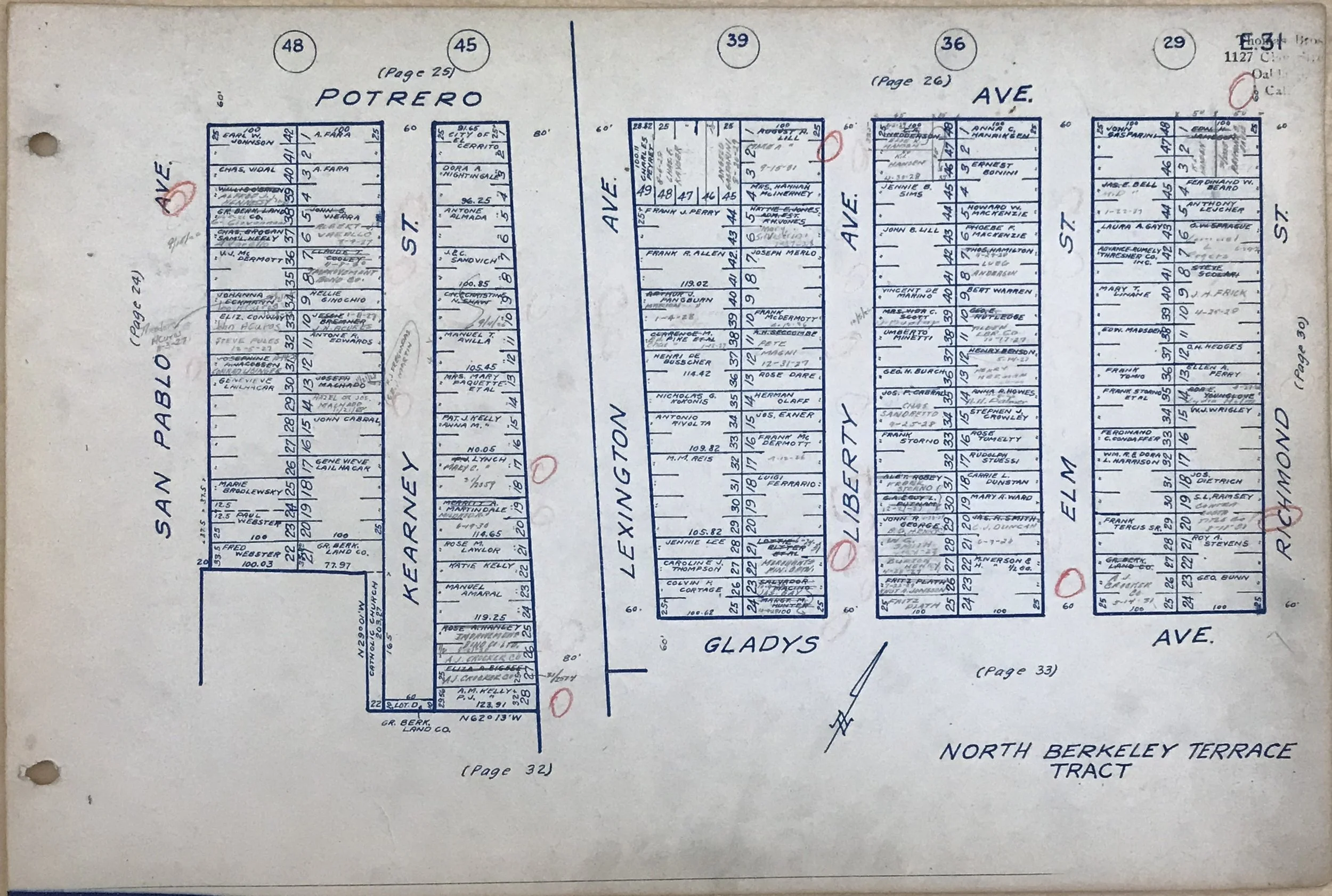
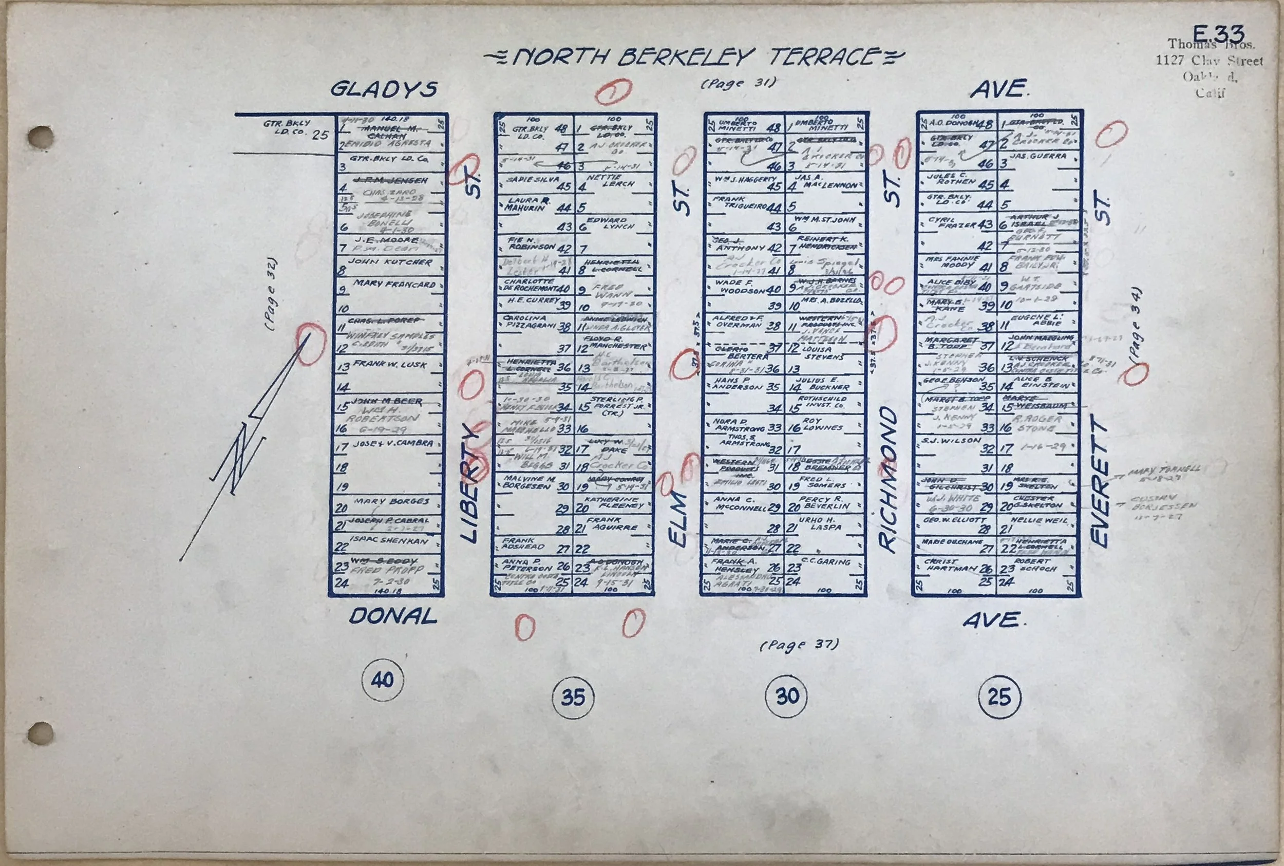
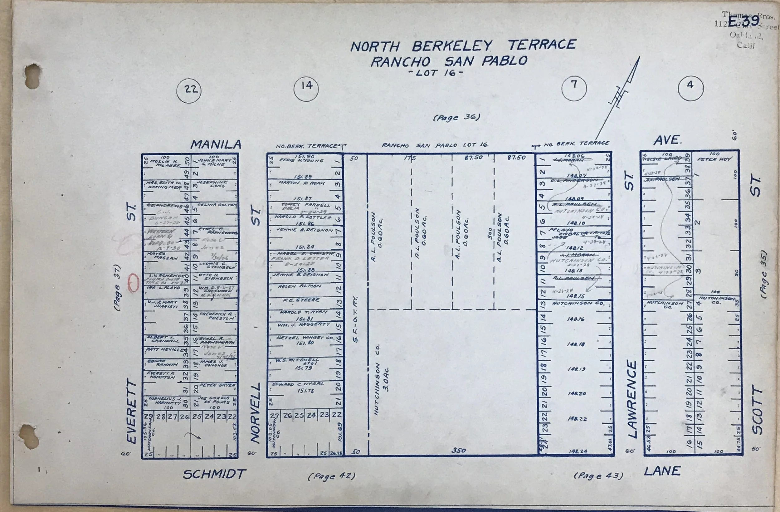
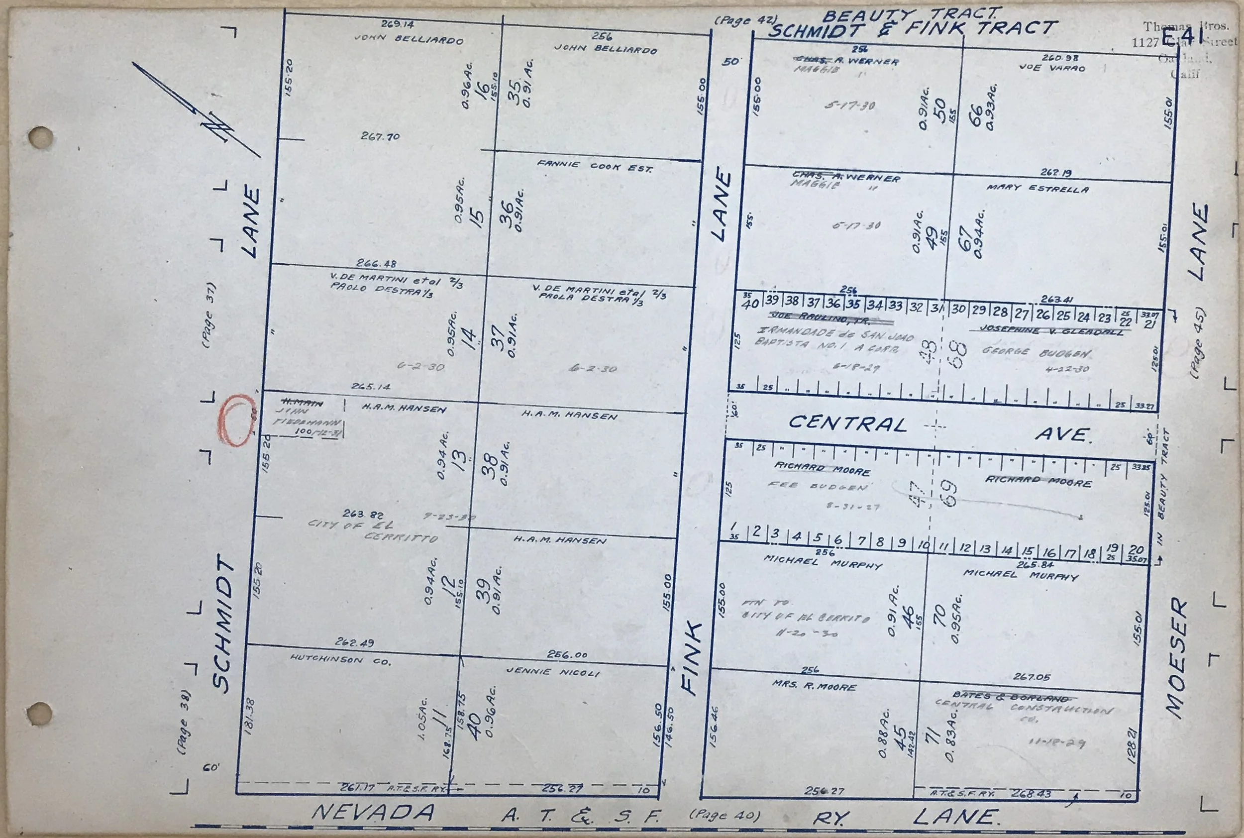
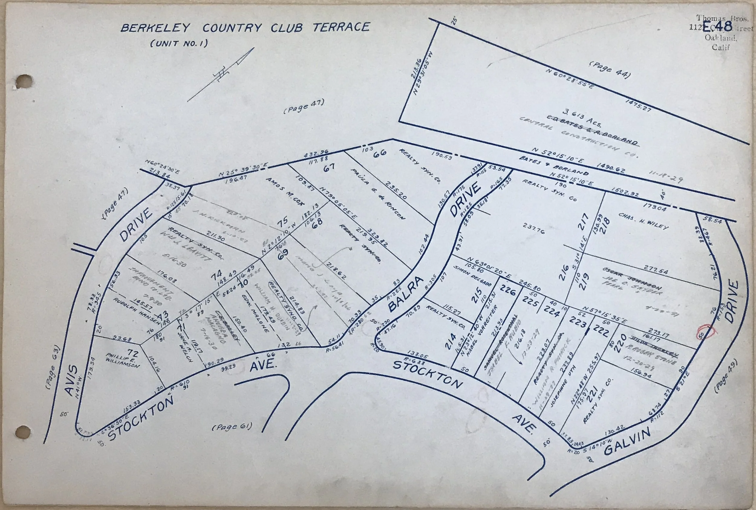
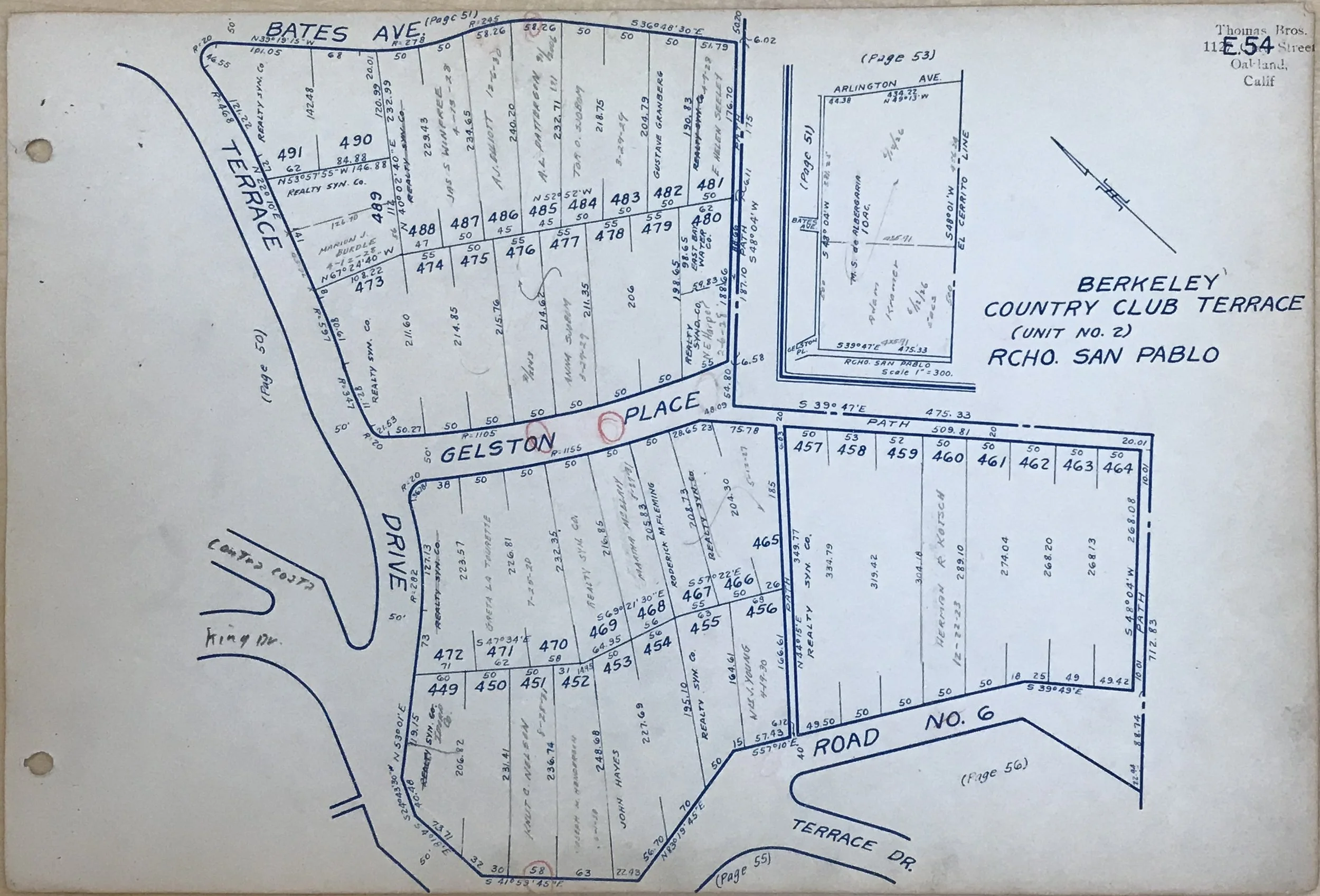
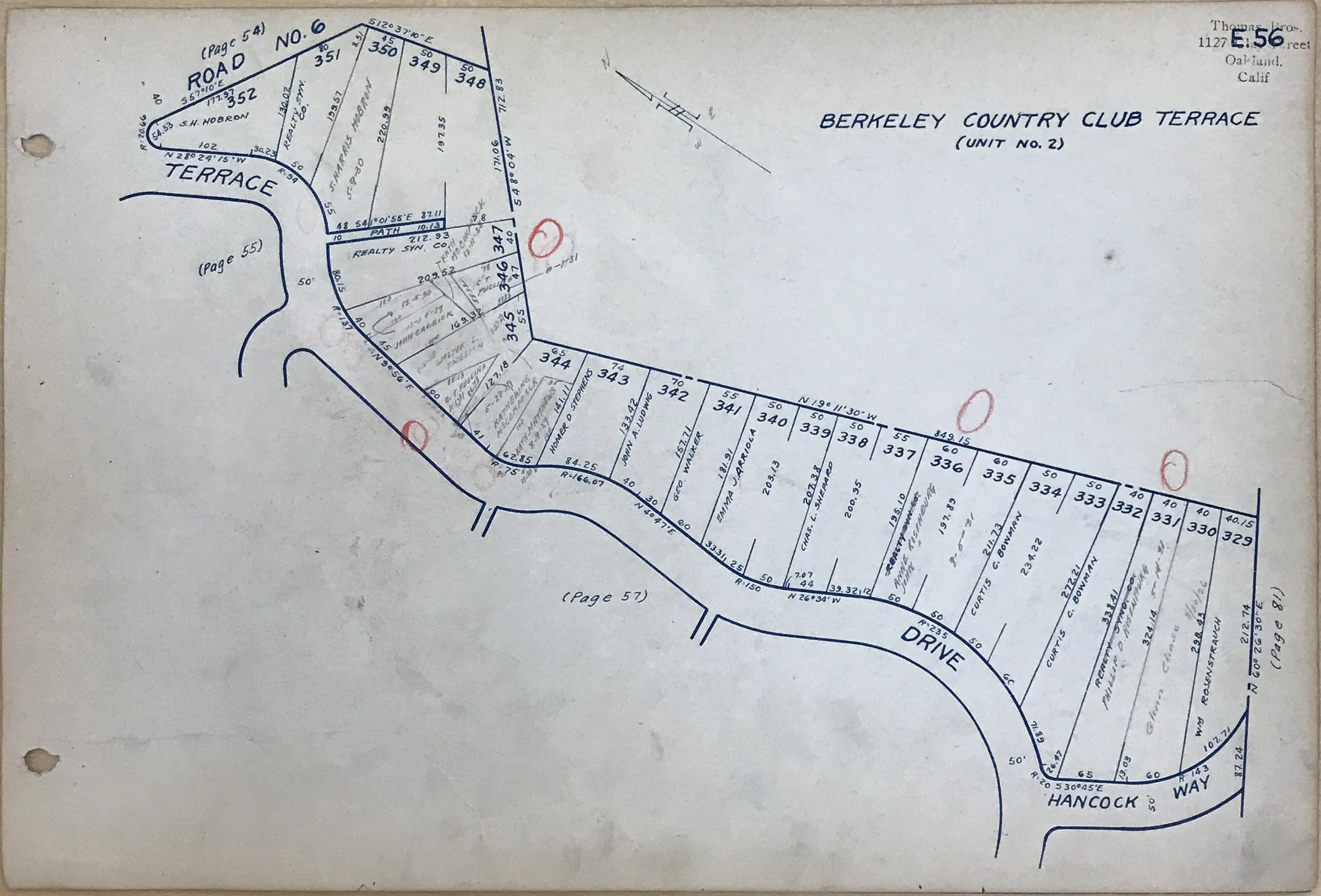
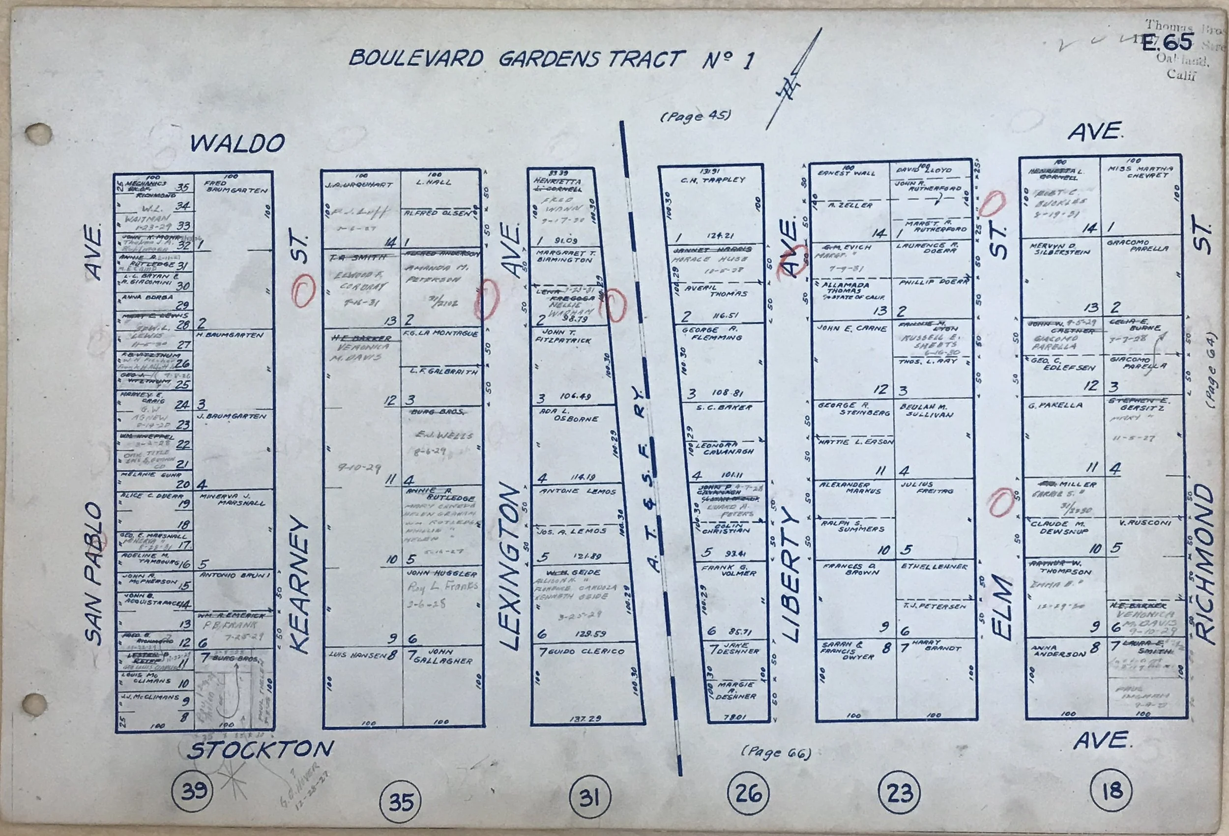
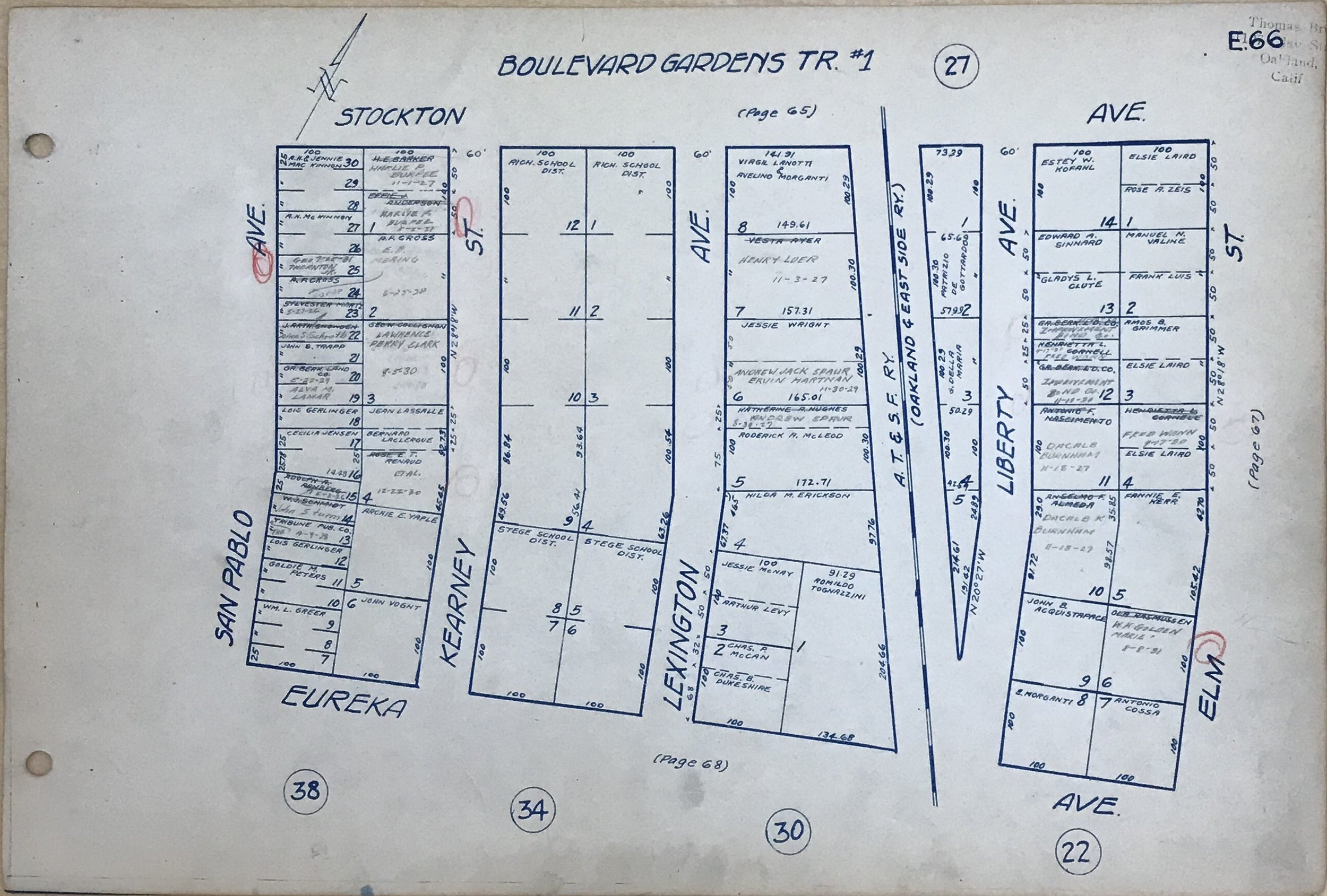
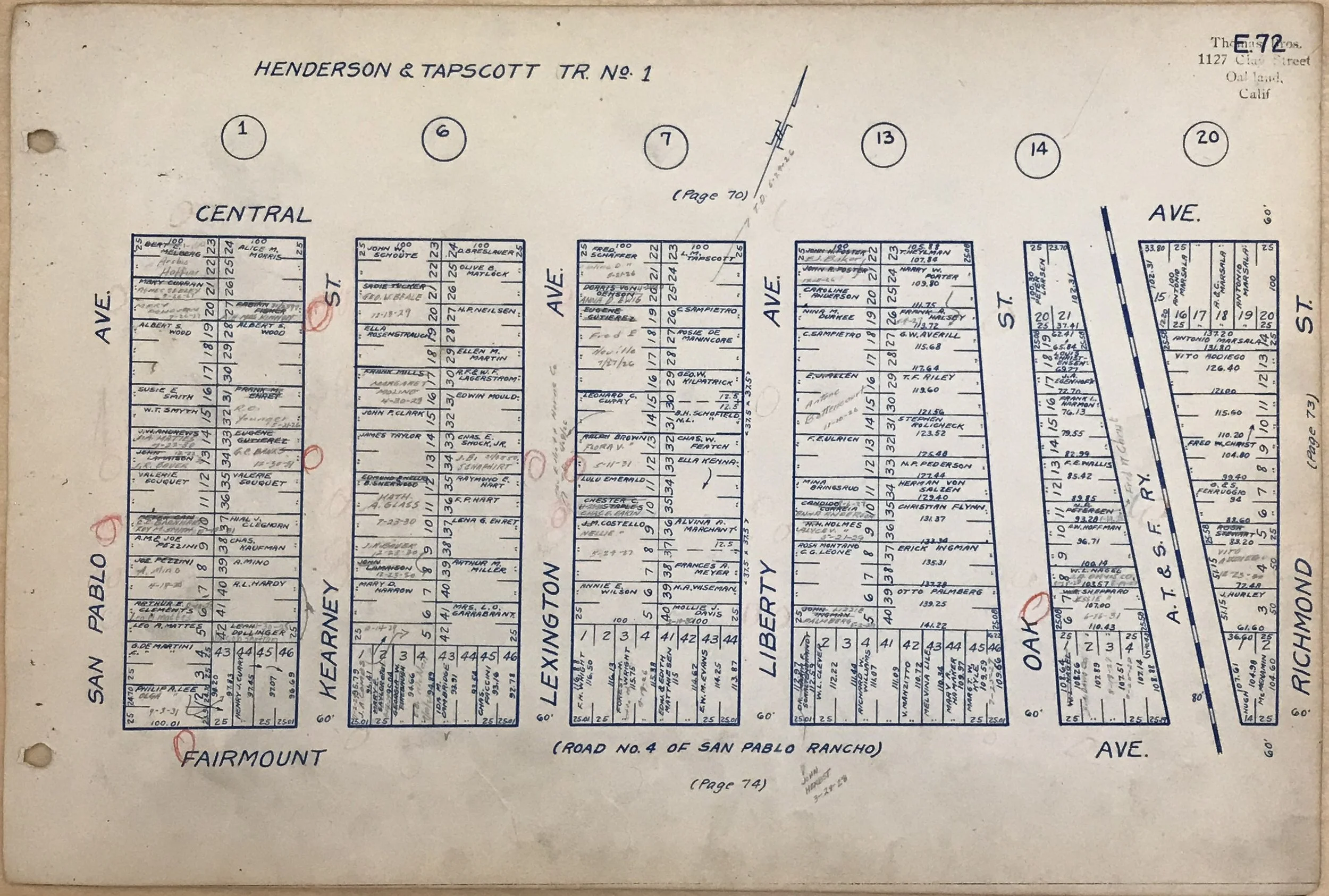
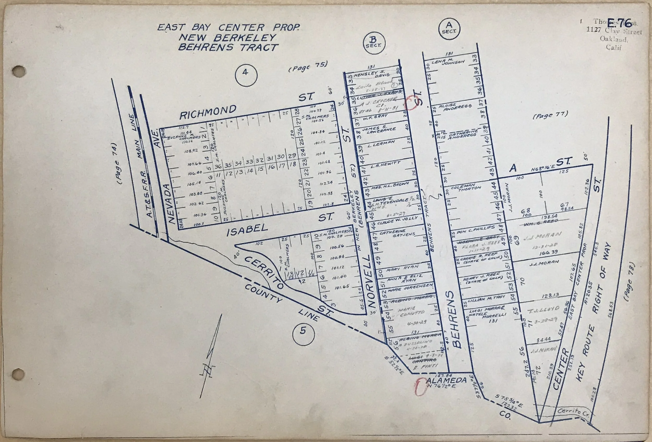
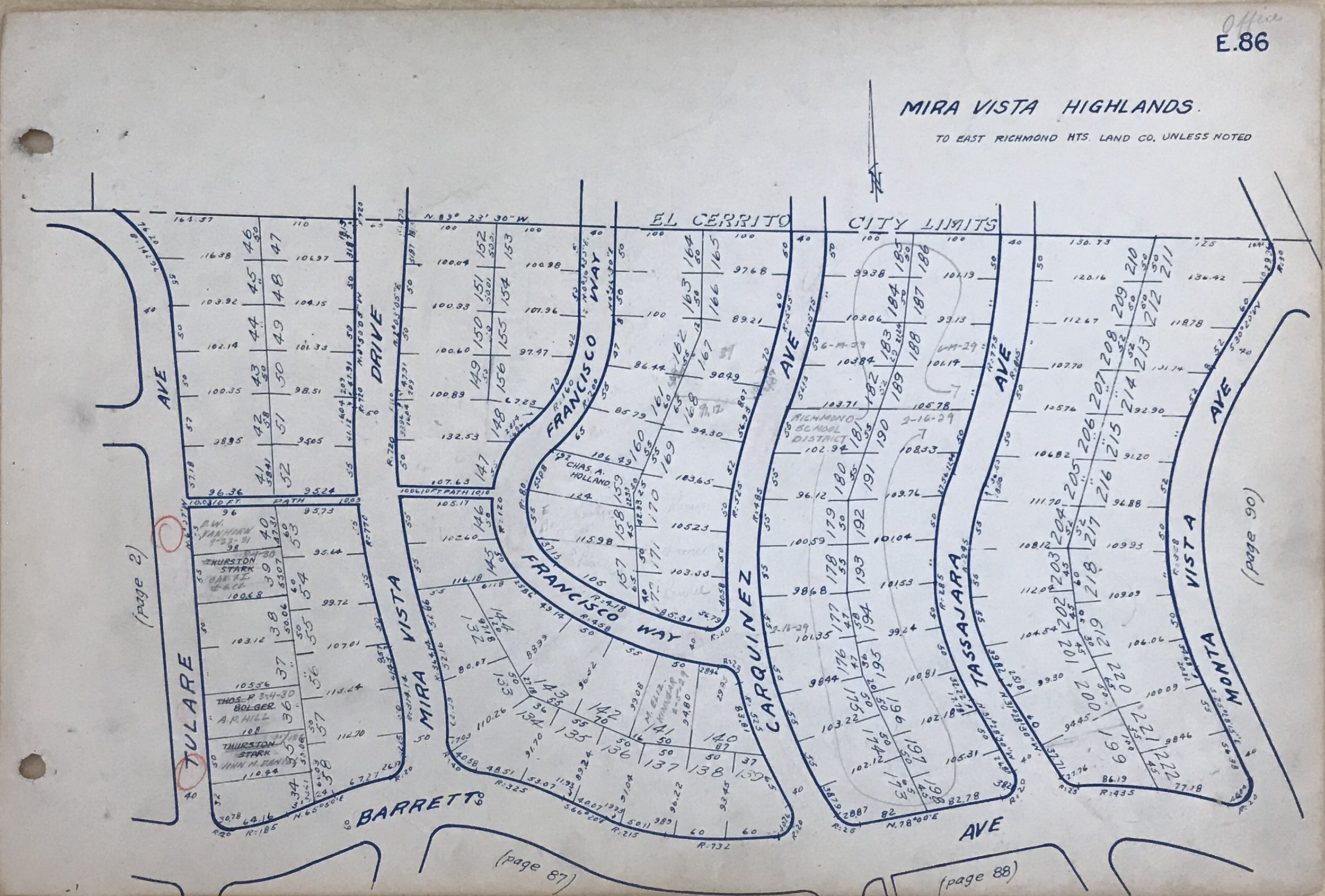
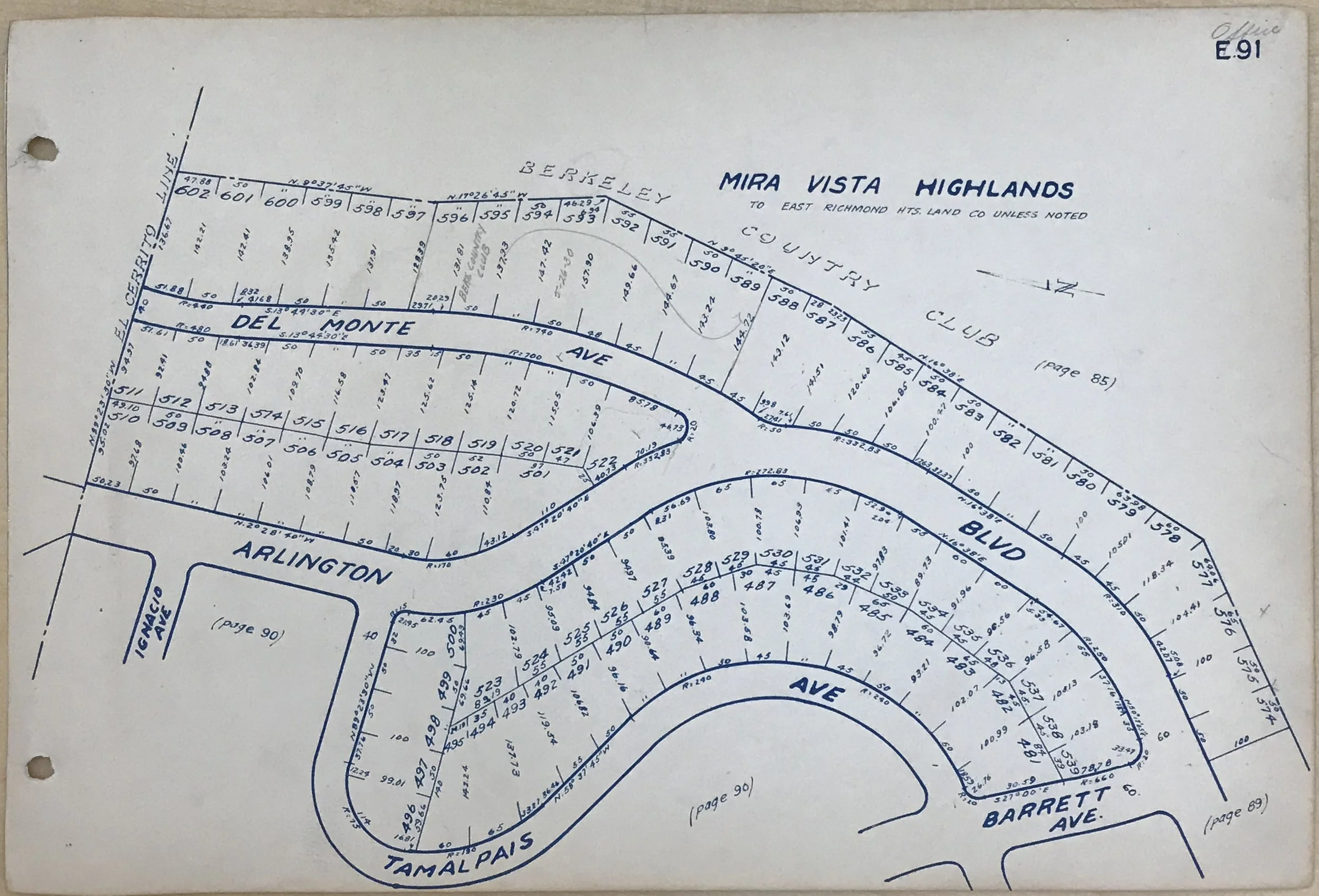
1926 block-by-block street maps of El Cerrito
Oakland, 1915: Cartographer George Coupland Thomas and his two brothers decide to launch a map-making business. Their company, Thomas Bros. Maps, publishes finely detailed street maps—invaluable resources for an ever-growing number of motorists who need directions through (and between) America’s rapidly expanding cities.
Over the next ninety-odd years, the Thomas Bros. Maps company publishes innumerable maps, including this 1926 volume documenting every street in El Cerrito, as well as ownership of nearly all the city’s land parcels.
The society thanks volunteer Elizabeth Patusco (El Cerrito High School class of 2027) for carefully photographing all 98 pages of this invaluable historical resource.